Let's talk about Retail Locator
Contact us today. We'll walk you through a live demo!

Millions of Relevant Locations in Easy to Use Tools
We've compiled the most popular and active Retailers, Education, Healthcare, Financial and other Services; placing them at your fingertips. Retail Locator harnesses our extensive location database to allow for national, market and street level mapping. Combined with a number of smart targeting tools, Retail Locator provides fast response to media planning, distribution and other coverage related projects. Locations are continually updated and because we focus on the most relevant brands and chains, searching through endless data is a thing of the past. Going beyond just mapping, our full set of reports provide the power for your most challenging data projects.
Want to Try it Out?
Click on the button below. You can search our complete database of locations and see a map across the country.
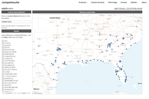
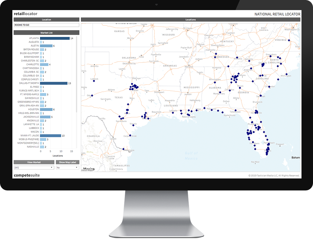
National Market Coverage Map
Comprehensive set of curated locations that are relevant to media planners and operations professionals.
- View over 7,900 Brands
- Over 3.8 million curated locations
- Single view coverage
- Completely dynamic mapping
- Filter by Market
- Evaluate market store saturation
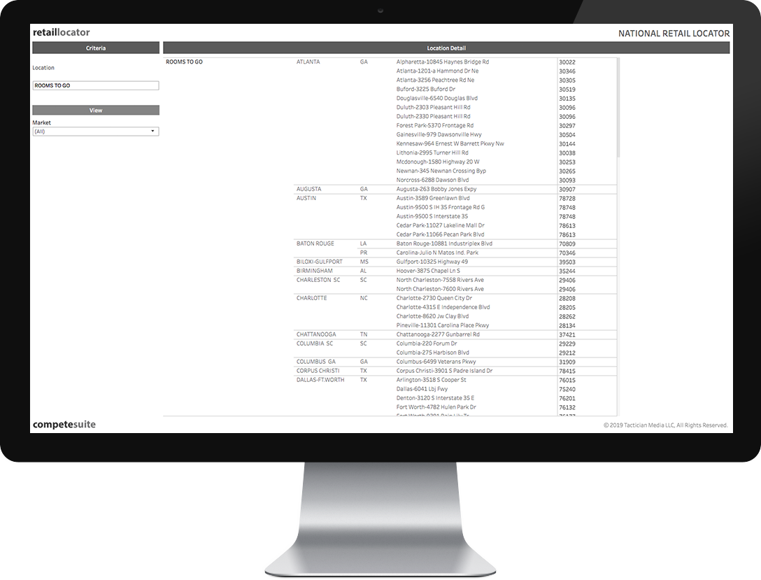
Location Detail
Organized and complete detail on millions of locations.
- View or Download Location data
- Full address files
- Sort by Market, County and City
- Dynamic reporting tools connected to mapping
- Import into Excel
- Output to PDF or PowerPoint
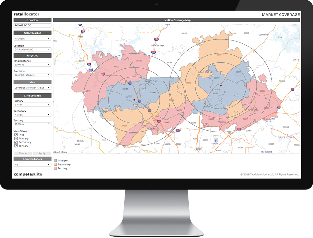
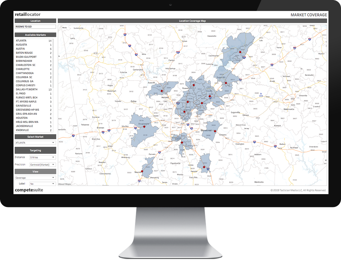
Market Coverage
Interactive and dynamic tools to determine the best coverage area around locations. Save hundreds of hours of labor with our fast algorithms.
- View location coverage area by ZipCode
- Centroid and Intersection assignment
- View single market or larger area
- Change the Radius
- Modify the search method
- Fully interactive street layers and interstates
- Output to PDF
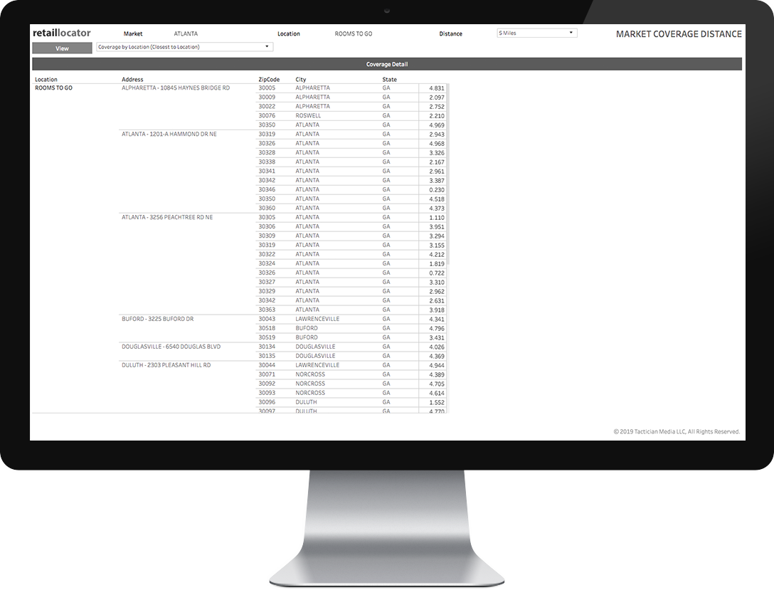
Coverage Detail
Complete detail of coverage areas as well as reporting on surrounding areas across location landscape.
- Comprehensive reporting options
- Show coverage by distance
- Filter by Market, County, City
- Allocated ZipCodes for each location
- Both duplicated and unduplicated views
- Conduct “What if” scenarios easily
- Output to Excel or CSV
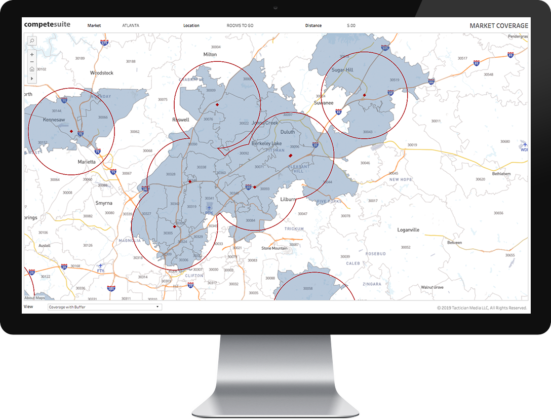
Interactive Coverage Mapping
Pinch, zoom, pan and output an inclusive street map while surveying locations and coverage areas.
- Select one or many locations
- Interactive pinch and zoom
- Full street level detail
- Radial formatting
- Buffering available
- Output to PDF
- Print from letter up to wall sized poster
Advanced Analysis Tools
Go beyond basic coverage and evaluate trade areas and site influences across an area.
- Coverage Slicing
- Territorial assignment
- Influence Gap Assessment
- Multiple distance areas
- Location Assignment
- Contextual Assessment
- Output to PDF